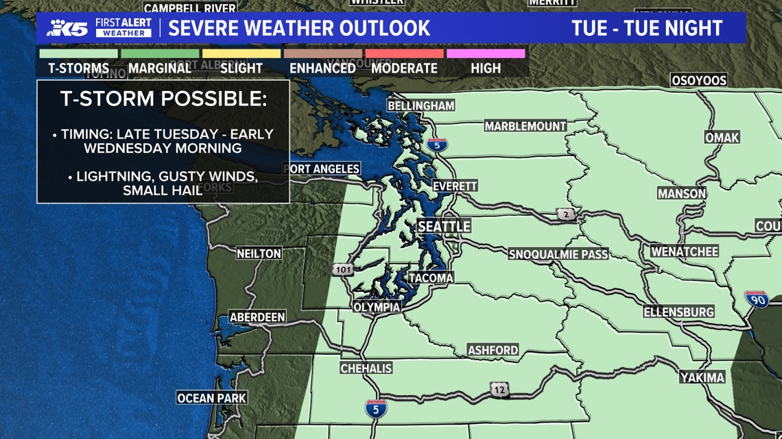
Thunderstorm chances are strongest in the Cascades overnight into Wednesday. Drivers should expect a wet and possibly slick morning commute.

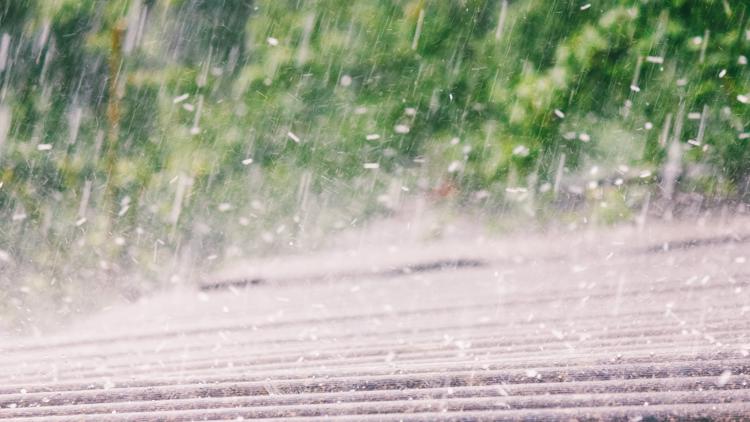
SEATTLE — Soak up the warmth Tuesday — it’s the last day in the 70s and 80s for a while. Wednesday will bring a nearly 20-degree temperature swing, alongside overnight chances of thunderstorms and widespread rain.
While a pop-up storm cannot be ruled out Tuesday afternoon or evening, thunderstorms are most likely overnight into Wednesday morning, especially over the Cascades, but significant or widespread damage is not expected.
The rain Wednesday will snap a nearly two-week dry stretch as western Washington saw temperatures reach more than 80 degrees, including some record-breaking highs.
Drivers should prepare for a wet and potentially slick morning commute.
Here’s what to know about the timeline for the shift in weather:
Tuesday afternoon
High pressure pushes east Tuesday afternoon, and with it goes the warmth. An incoming upper-level low will bring rain and a chance of thunderstorms to the region, especially over the Cascades.
There’s a chance of pop up storm in the afternoon, but the strongest chance for thunderstorms is during the overnight hours.
Overnight Tuesday into Wednesday
The main window of opportunity for thunderstorms in western Washington will begin after 10 p.m. through about 6 a.m. or so. The thunderstorm potential is highest over the Cascades and Foothills and east of the Cascades. However, the I-5 corridor and the Kitsap Peninsula have the potential to hear rumbles of thunder, as well.
A narrow band of rain pushes from south to north from Oregon into western Washington late tonight through early Wednesday morning.
Wednesday
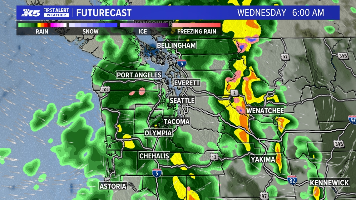
The early Wednesday rain is likely to impact the morning commute, and could make roads slick from oil accumulated on the surface during the dry stretch.
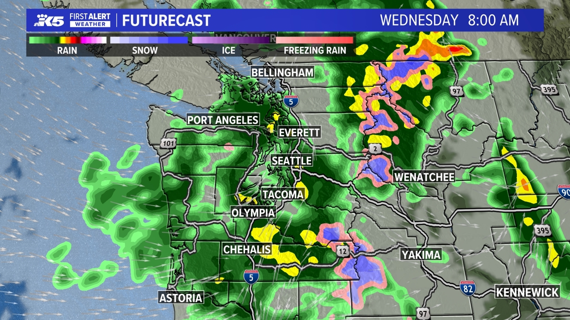
A second wave of rain will move from west to east across western Washington later in the morning.
Rain will taper to showers into the afternoon, but winds will crank up out of the southwest/west. Wind gusts of 25 to 30+ mph are possible at times, easing by Wednesday night. The strongest wind gusts are expected east of the Cascades and could reach over 40-50 mph.
Highs on Wednesday will only reach the mid 50s to low 60s — a jarring change from today’s heat!
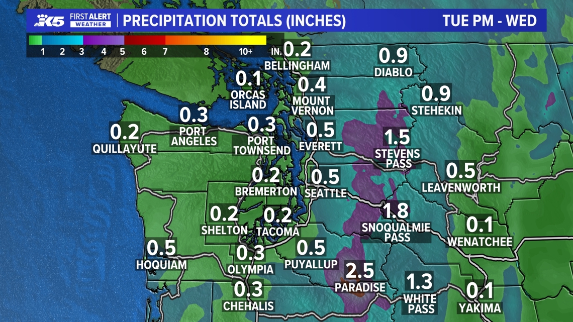
Rain totals
Rain accumulations through Wednesday look to reach around 0.25″ to 0.50″ for the lowlands and the coast and 0.50″ to more than 1″ in the foothills and Cascades. If a convergence zone sets up over the North and Central Sound, some areas could see locally higher rain totals.
The rest of the week
The unsettled pattern continues through the second half of the week as a series of weak disturbances move through Thursday into Saturday, keeping showers in the forecast and temperatures a bit cooler than normal in the mid 50s to low 60s.
Waves of showers are expected late Thursday into Friday and again later Friday into Saturday.
High pressure is expected to gradually rebuild Sunday, bringing milder and drier conditions to the area.

To ensure diverse coverage and expert insight across a wide range of topics, our publication features contributions from multiple staff writers with varied areas of expertise.